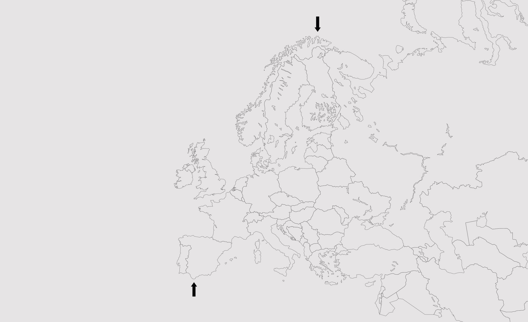
Endpunkt Europa
Endpunkt Europa (Mikroskopie), (extract), inkjet prints, microscope trays, endpoints, 290x75cm, 2017ESEM Microscopy of Europe‘s northern- and southernmost edge. With the friendly support of Dr. Rudolph Reimer (Heinrich Pette Institute (HPI) / Leibniz-Institut für Experimentelle Virologie, Hamburg).
Endpunkt Europa is a multifaceted artistic intervention that explores human mesoscopic behavior and questions the concepts of borders and cartographies at the most Southern and most Northern geographical points of Continental Europe.
"How long is the coast of Great Britain?" Mathematician Benoit Mandelbrot famously asked in 1965. There is famously no answer to this question; one can only approach it. The artist approached this challenge similarly, using the electron microscope to extract a section—the outermost bifurcation, the tip of a coast. After argon–gold 'sputtering' to counteract potential material charging under electron bombardment and ensure accurate image transfer, the exploration continued along the outermost bifurcation.
Tragically, an objective measure for the length of a coast cannot be found; both measurement and observation are inherently subjective, dependent on the precision and resolution of the instrument used. Without subjective observation, such measures do not exist.
This project was funded by the German Federal Ministry of Education and Research, MS Wissenschaft, and WID. The installation includes inkjet prints measuring 110x75 cm, microscope trays with "endpoints," and a 1-channel video documenting the artist's journey to two dramatically different ends of Continental Europe.
Endpunkt Europa (Mikroskopie), (installation view), Inkjet prints, microscope trays, endpoints, 290x75cm, at Sees & Oceans at MS Wissenschaft, Bonn 2017
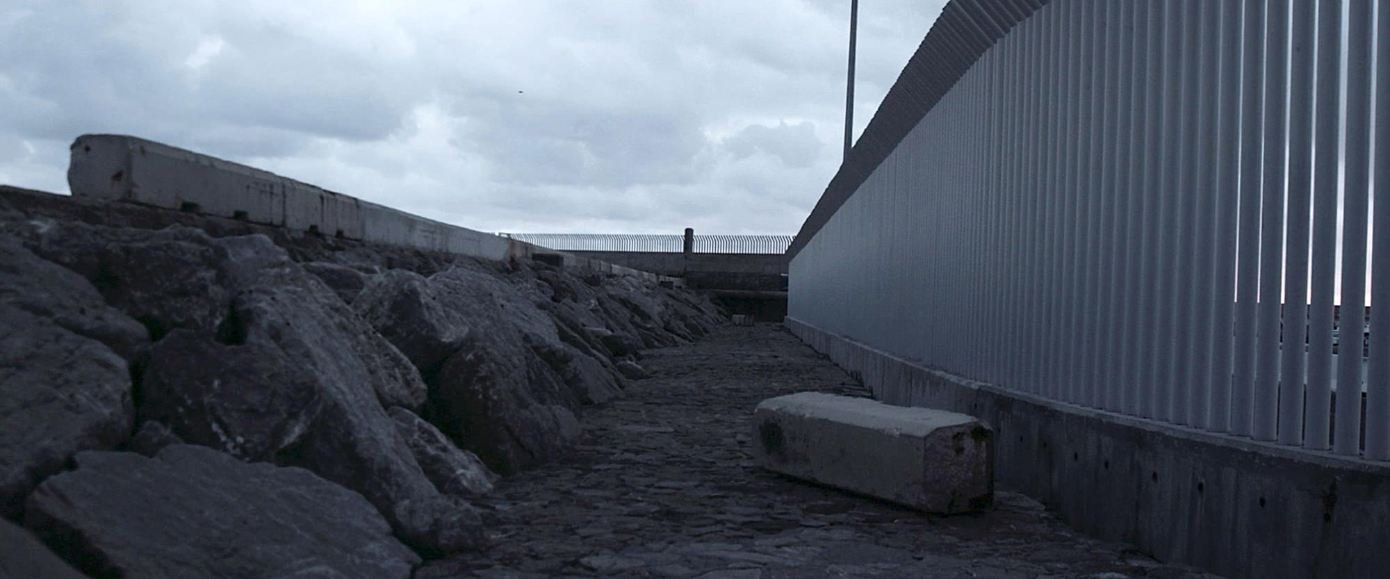
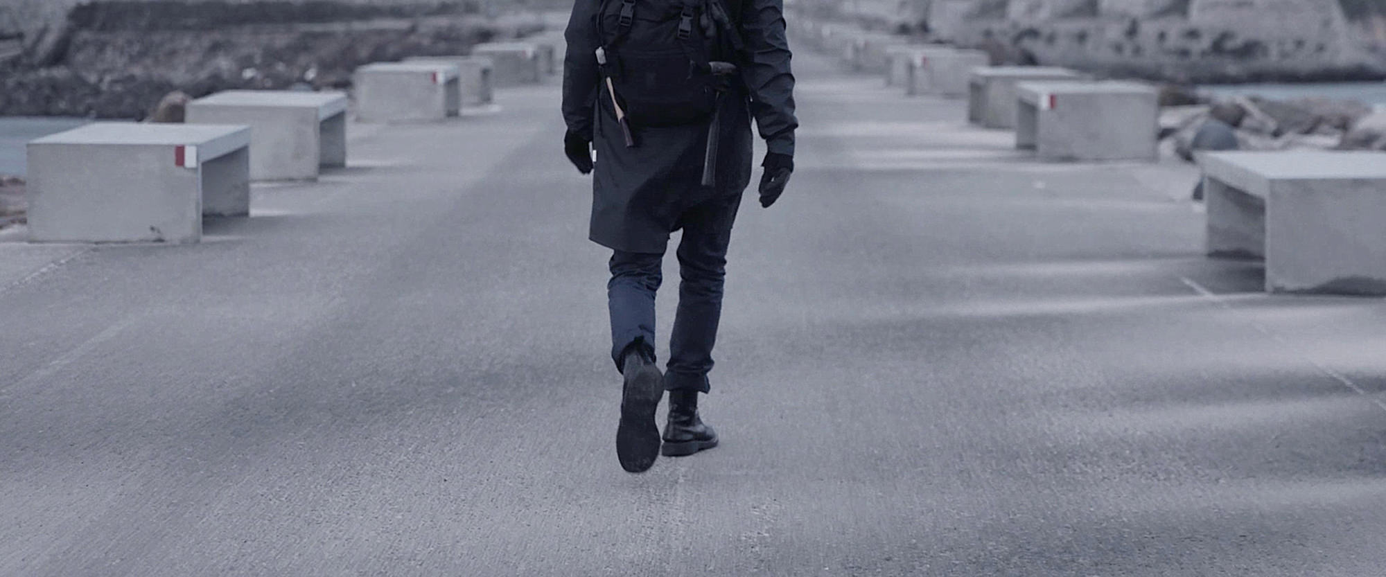
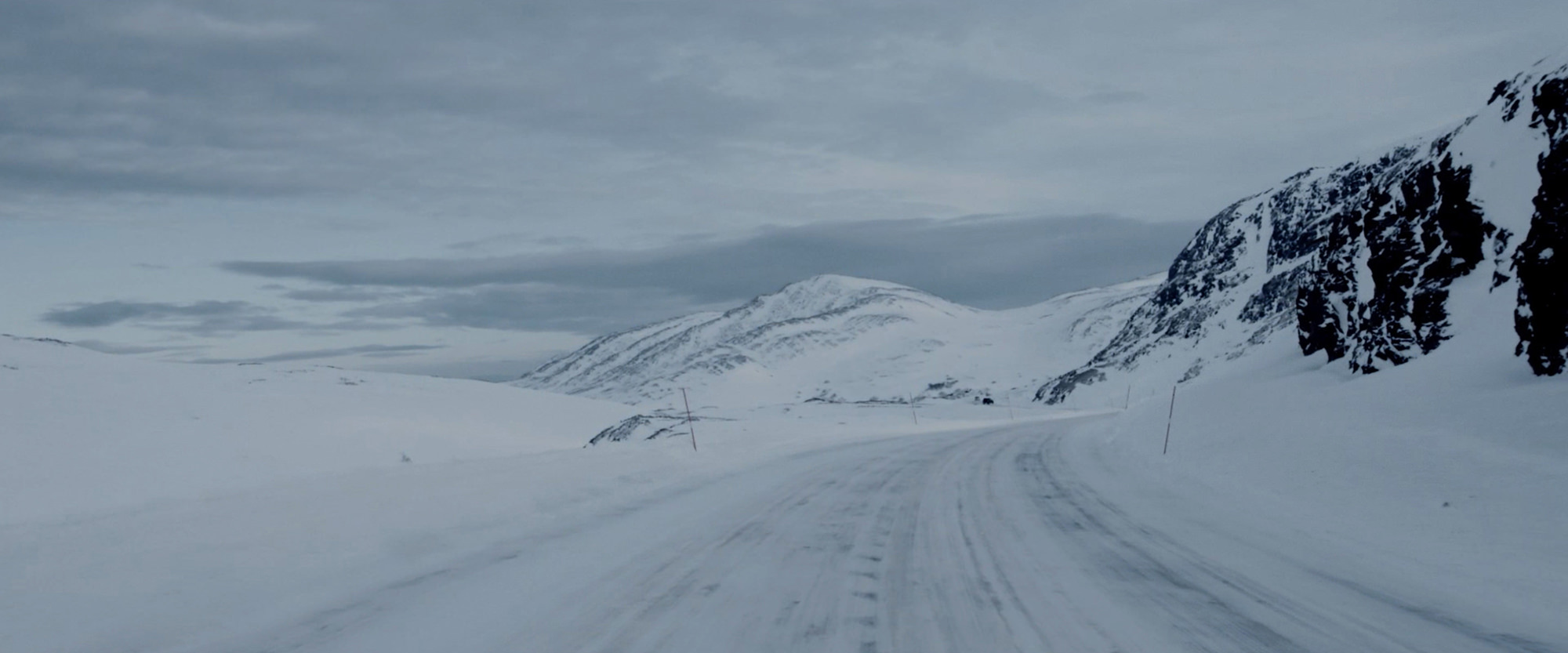
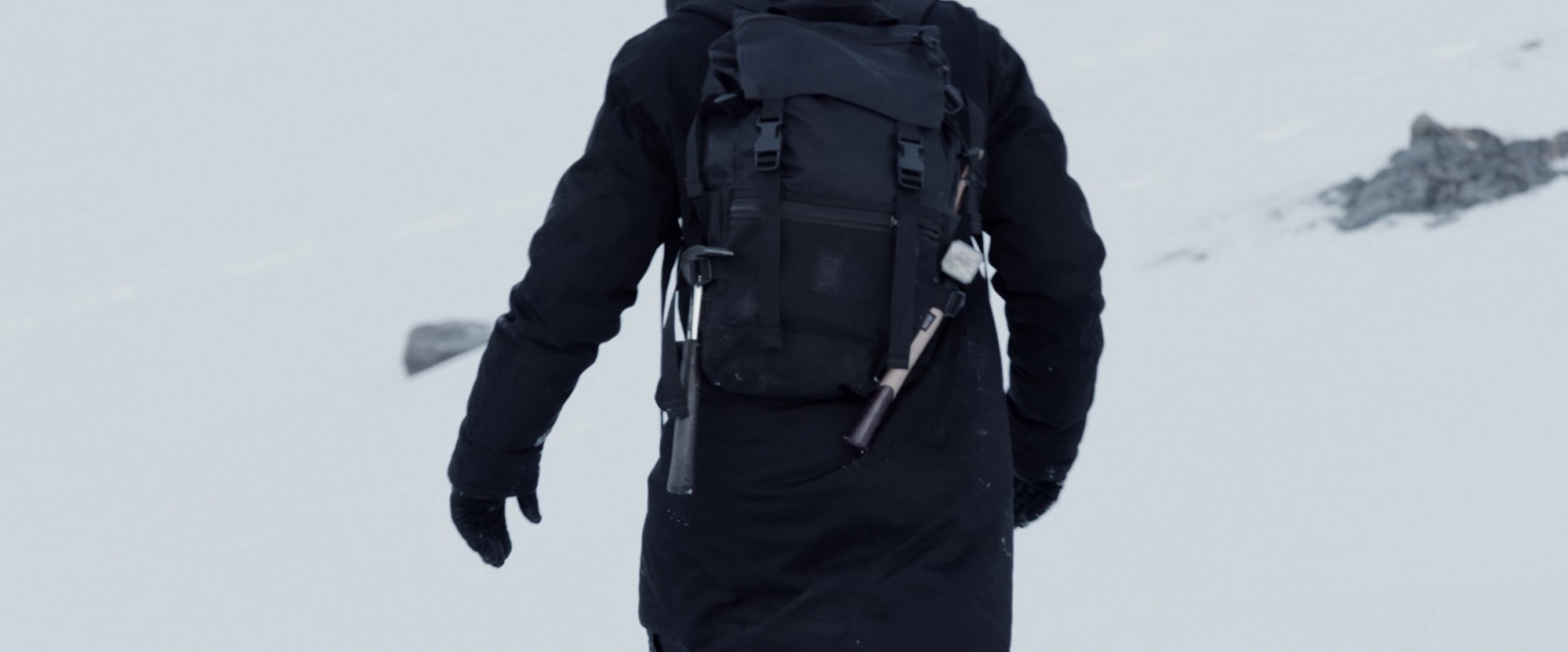
The video work ‚Endpoint Europe‘ juxtaposes two dramatically different ends of Continental Europe: Cape Nordkyn in Norwayand Tarifa in Spain. While the journey to the North proved challenging due to the cold, untrodden landsand white nothingness, the journey to the South revealed obstacles of bureaucraticnature. Islas de las Palomas, Tarifa’s most southern peninsula, appears as a dystopian amalgam of off-season surf tourism, ancient history of fortresses and a high-tech frontier for the current migrant crisis.
Production: Marietta AurasDoP: Cedric RetzmannEditor: Philipp MüllerSound Design: Felix Kiessling / Alexander MüllSpecial thanks to Vidar Karlstad & Team, Nordic Safari Wildlife Adventures AS, Benjamin Ude, Fisherman Antonio, Guardia Civil Gibraltar/Ministerio Del Interior, 25p Cine Support Berlin, Maya Röttger, Alexander Levy, Lydia Ahrens, Beate Langholf, Maren Grüber, Prof. Dr. Rudolph Reimer, Heinrich Pette Institut/Leibniz-Institut für Experimentelle Virologie Hamburg, Jakob Zoche, Alexander Müll, Carolin Oetzel.
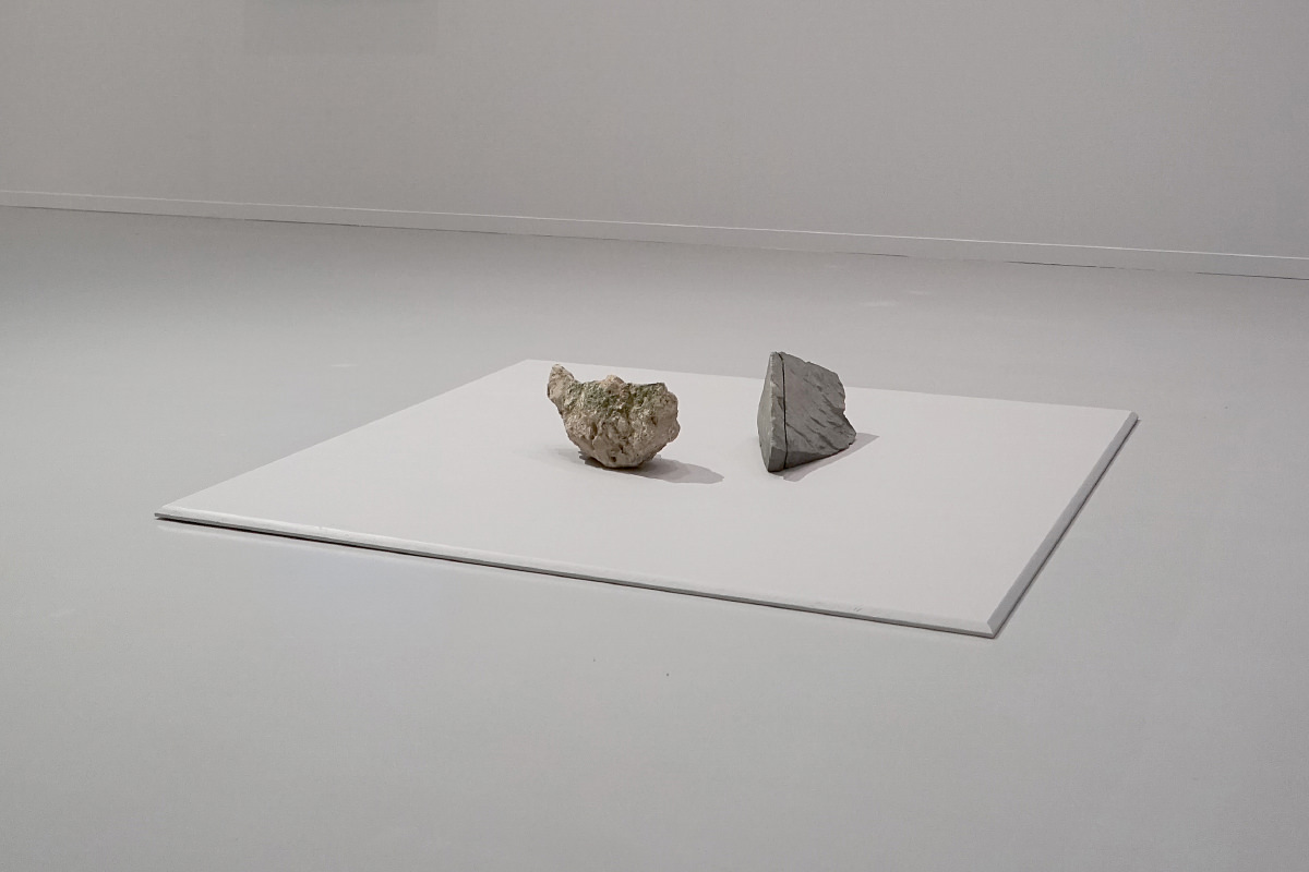
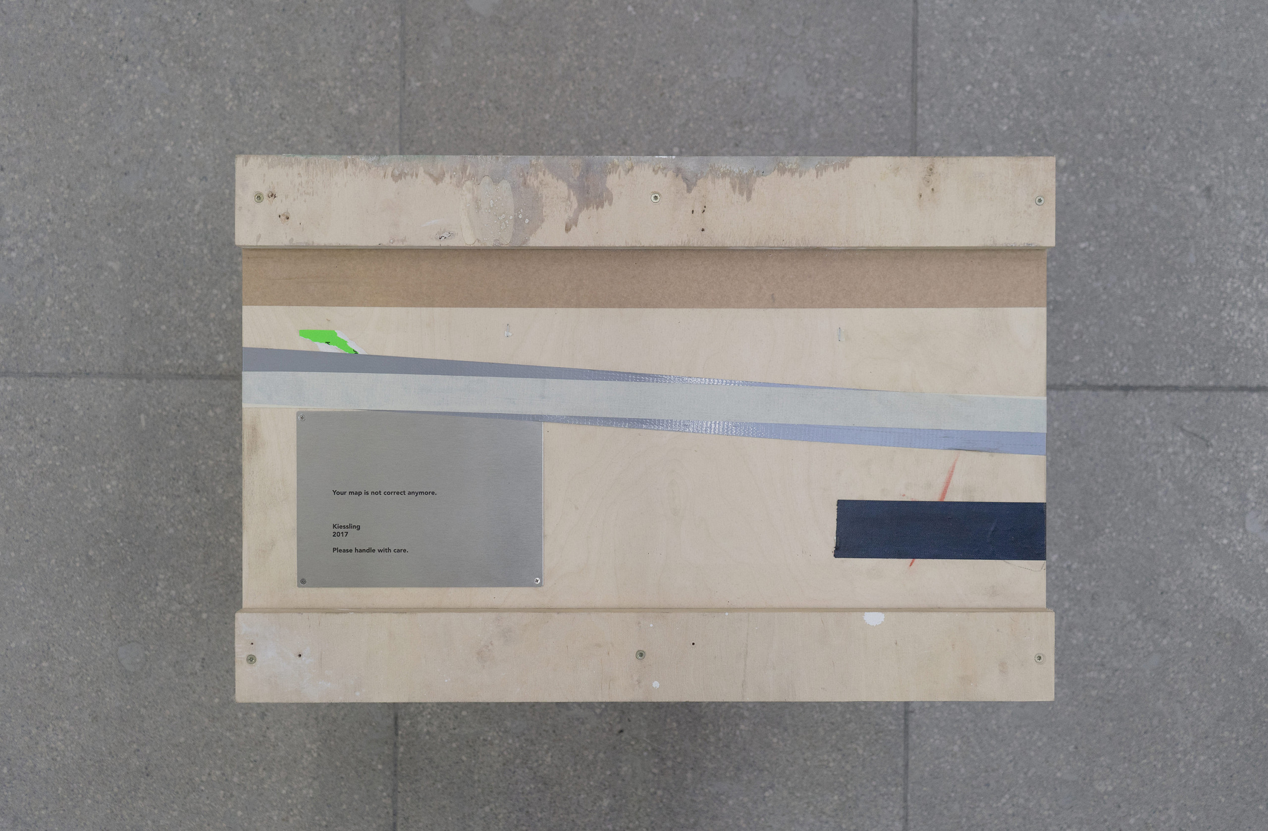
Physically shortening continental Europe’s most northern end in Norway (Cape Nordkyn), as well as its most southern tip in Spain (Tarifa) by 40 cm resulting 'Your map is not correct anymore.' (2017). Both continental edges were exhibited, crated in Hamburger Bahnhof, 2018, as well as open at Sprengel Museum Hannover 2018.
Your map is not correct anymore. 2017Shipping crate containing 2 rocks: The North- and South end of Europe, 40 x 60 x 70 cmFestival of Future Nows, Hamburger Bahnhof – Museum für Gegenwart, Staatliche Museen zu Berlin, 2017
Installation view of Your map is not correct anymore. 2017 at Festival of Future Nows, Hamburger Bahnhof – Museum für Gegenwart, Berlin, 2017